Category Archives: Science Direction

Setup (4): Team Planning for Re-planting

Pre 2000’s the accepted narrative for establishing reforestation projects was preparation >plant>photo opp> move on. 3 year post reforestation maintenance programs is now the narrative in most projects depending on location.(Marcus Yates, 2024)

The following are notes I’ve made to track the plan for the regeneration process:

Suggested Planting date in active site approx. Thurs April 25th 

Preparation

Slash the area 6 weeks prior to date of planting  21 March 2024

  • Position site pegs across gully from east -west
  • Spray 1m diameter circles around planning site with appropriate herbicide and emerging woody environmental weeds (Biactive – surfactant does not harm aquatic organisms) with the addition of Fulvic acid which increases biodegradability of the glyphosate molecule, increases soil carbon and reduces herbicide/water ration by 1/3) + a squirt of dishwashing liquid (breaks the surface tension of H2O thus increasing contact with the cuticle of leaves
  • Spray again 1 week prior to planting. April 18th 2024
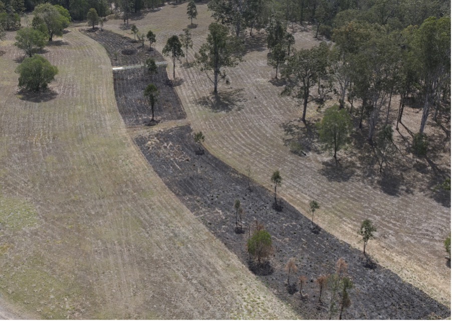
Aerial burn site of regeneration area, SERF.
SERF Aerial burn Site (Image courtesy QUT REF Team)

Planting

  • Purchase selected spp from local nurseries. Ensures hardier stock grown from parent trees from the local provenance
  • Sun “harden’ stock in full sun for 2 weeks prior to planting April 9th 2024
  • Mechanical dig planting hole a day or two before planting date. April 23rd 
  • Must have adequate sub soil moisture on the day of the planting.Otherwise reschedule
  • Saturate plants on the morning of the planting
  • Group demonstration of the techniques used to eliminate/minimise transplant stress
  • Place inoculated soil in planting hole
  • Secure weed mat and tree guard. Tree guards create a micro climate of increased humidity and protects against the wind, reducing the plant losing moisture from transpiration (reduces transplant stress). Protects from herbicide overspray and animals grazing (wallabies and hares)
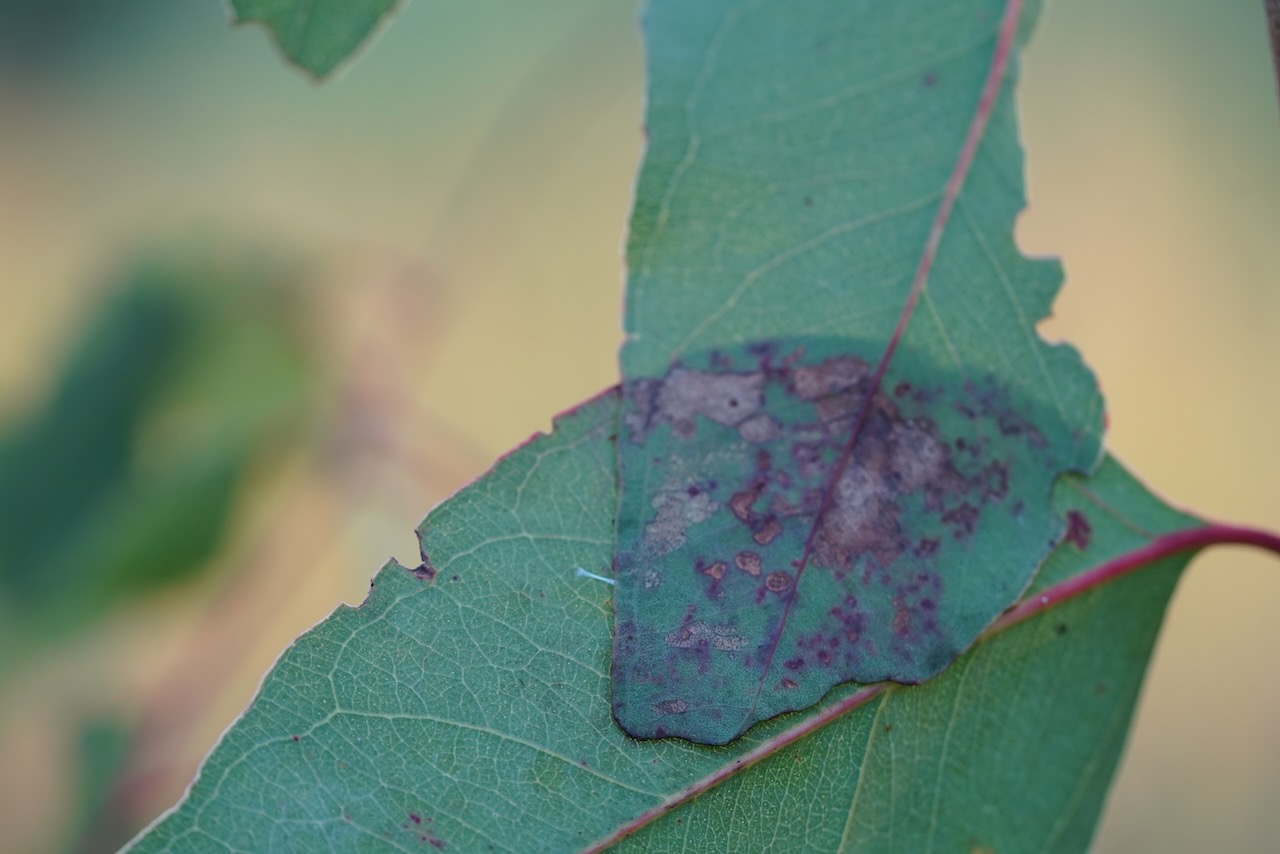
Overlapping eucalypt leaves
Overlapping Eucalypt Leaves, SERF, 2024 (Image Keith Armstrong)

Maintenance

  • Replant plant losses when suitable.
  • 6 -10 week Spray routines around plants and neighbouring woody weeds (dependent on local weather conditions and seasons)
  • Slash when required
  • Brush cut inter rows (when required)
  • Form prune to retain one leader when required (approx. 1st and 3rd month post planting)
  • Remove tree guards when tree is 3 x height of guard
  • Continued monitoring of natural regen
  • Interplant where required

Relevant read: 

https://ris.cdu.edu.au/ws/portalfiles/portal/72716695/Preece_et_al_2023_JEnvMgt.pdf
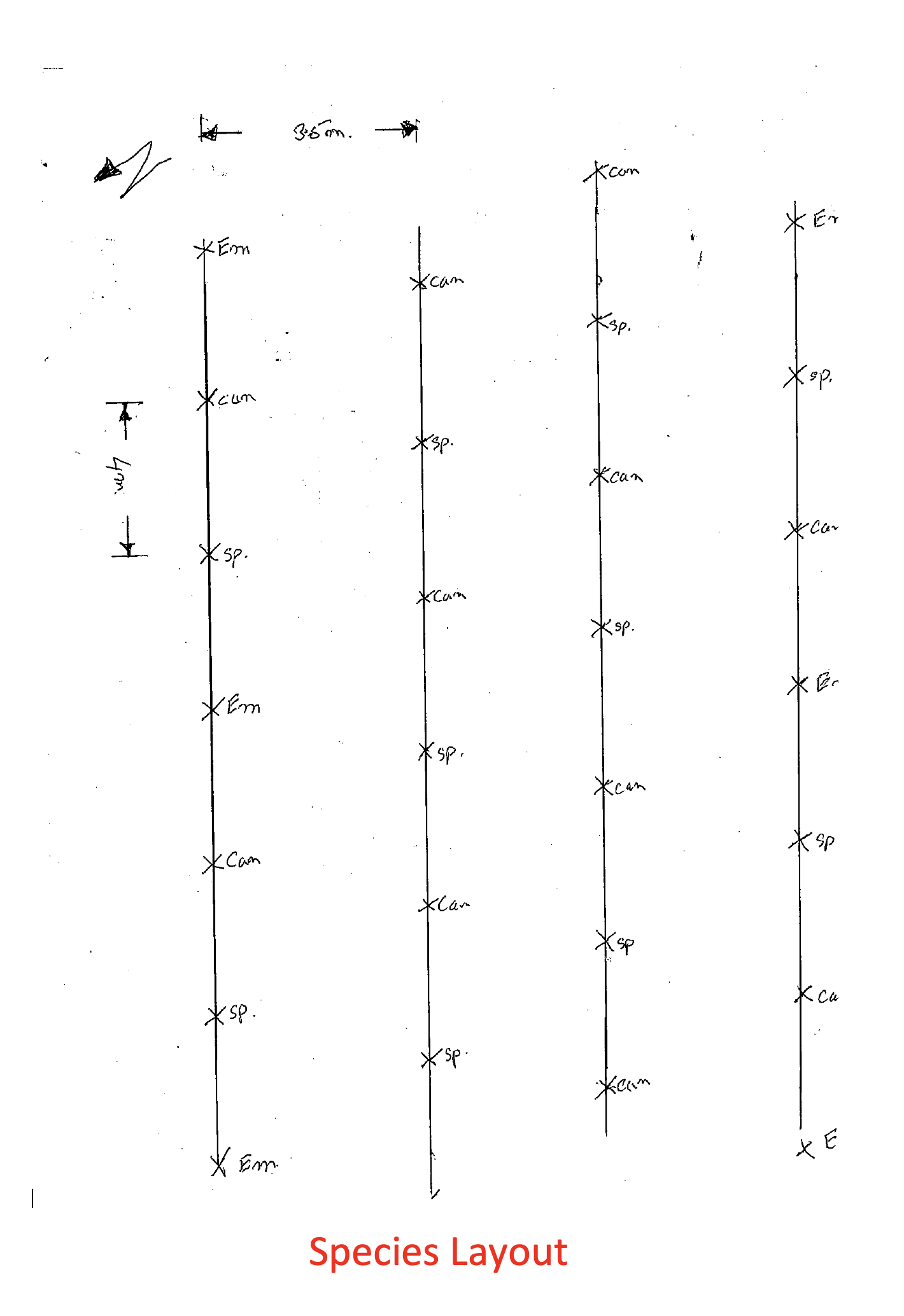
Tree planting plan for active regeneration area (Courtesy Marcus Yates)
Tree planting plan (Courtesy Marcus Yates)

Planned Planting: Species Layout

EM – Emergent species

C – Canopy species

Sp.- Space for sub canopy species and shrubs (or natural regen) as part of stage 2 planting. Est > April 2026 or when canopy semi closes

Setup (3): The Site/Scientific Intentions

The FAI project initiates a collaboration between ecological scientists, artists and land managers to conduct a forest regeneration processes, and over time use that forest’s growth to direct an experimental media arts practice. The  central aim of the science is to effectively restore a previously cleared forest (using both active and passive techniques): and as that process develops create speculative artworks that can be seen to illuminate the ‘agency’ and ‘non-human intelligence’ of that re-growth process. These hybrid artworks should, in some way, have capacity to either actively or passively support those re-growth processes and present new ways to communicate, interpret & ‘narrativise’ ecological change at that site.

SERF’s Regional Ecosystem Map: (Image Dr.. David Tucker)

Two adjacent sites have been chosen at SERF for this project that are a total of 14199.305 square metres (1.42 hectares), and were likely logged decades ago.

Aerial image of the artwork sites at SERF – active and passive (Image Dr. David Tucker)

They comprise a grassy slope currently rich in native grass species and a seasonally wet gulley current overrun by weedy grasses dotted by occasional trees. Both sites most likely previously had a grassy understory similar to the adjacent existing forest. The methodology has involved assessing information about what was there beforehand from the pre-clearing data as well as examining remaining adjacent vegetation. The plan is to set in place a process to ultimately replicate prior densities for tree, shrub and ground layers. The objective is to use passive regeneration methods across a grassed slope area, and some assisted regeneration (using seedlings and weed control) in the wetter gulley area. Some of those original tree cover types may no longer available locally.

The ‘active’ artwork site at SERF (Image Dr. David Tucker)

The science component will be managed by QUT SERF scientists (David Tucker and Gabrielle Lebbink) supported and informed by TERN’s Eleanor Velasquez, with the growing and maintenance processes managed by SERF’s Marcus Yates. The arts component of the project will be directed by Keith Armstrong.

The ‘passive’ artwork site at SERF (Image Dr. David Tucker)

SITE DETAILS

Site 1: Passive regeneration area – grassed sloping bank, last slashed in July 23.
7163.647 sq. m passively managed plot – likely similar to the dominant veg at SERF RE of concern 12.12.12: https://apps.des.qld.gov.au/regional-ecosystems/details/?re=12.12.12)

Eucalyptus tereticornis, Corymbia intermedia, E. crebra +/- Lophostemon suaveolens woodland on Mesozoic to Proterozoic igneous rocks).

We will encourage the transition process on this plot via selective slashing, mulching, weeding, and the introduction of fallen habitat trees & occasional selective planting under Marcus Yates management and with advice and input from Dr David Tucker, Marcus Yates, Dr. Gabrielle Lebbink and Dr. Eleanor Velasquez.

Site 2: Active regeneration area – grassed seasonal wet gulley area – was burnt in August 2023. 7035.658 sq. m actively managed plot – likely an ecotone associated with wet gullies RE12.3.6, which reflects the forest type further along the drainage line:(https://apps.des.qld.gov.au/regional-ecosystems/details/?re=12.3.6)

Melaleuca quinquenervia +/- Eucalyptus tereticornis, Lophostemon suaveolens, Corymbia intermedia open forest on coastal alluvial plains

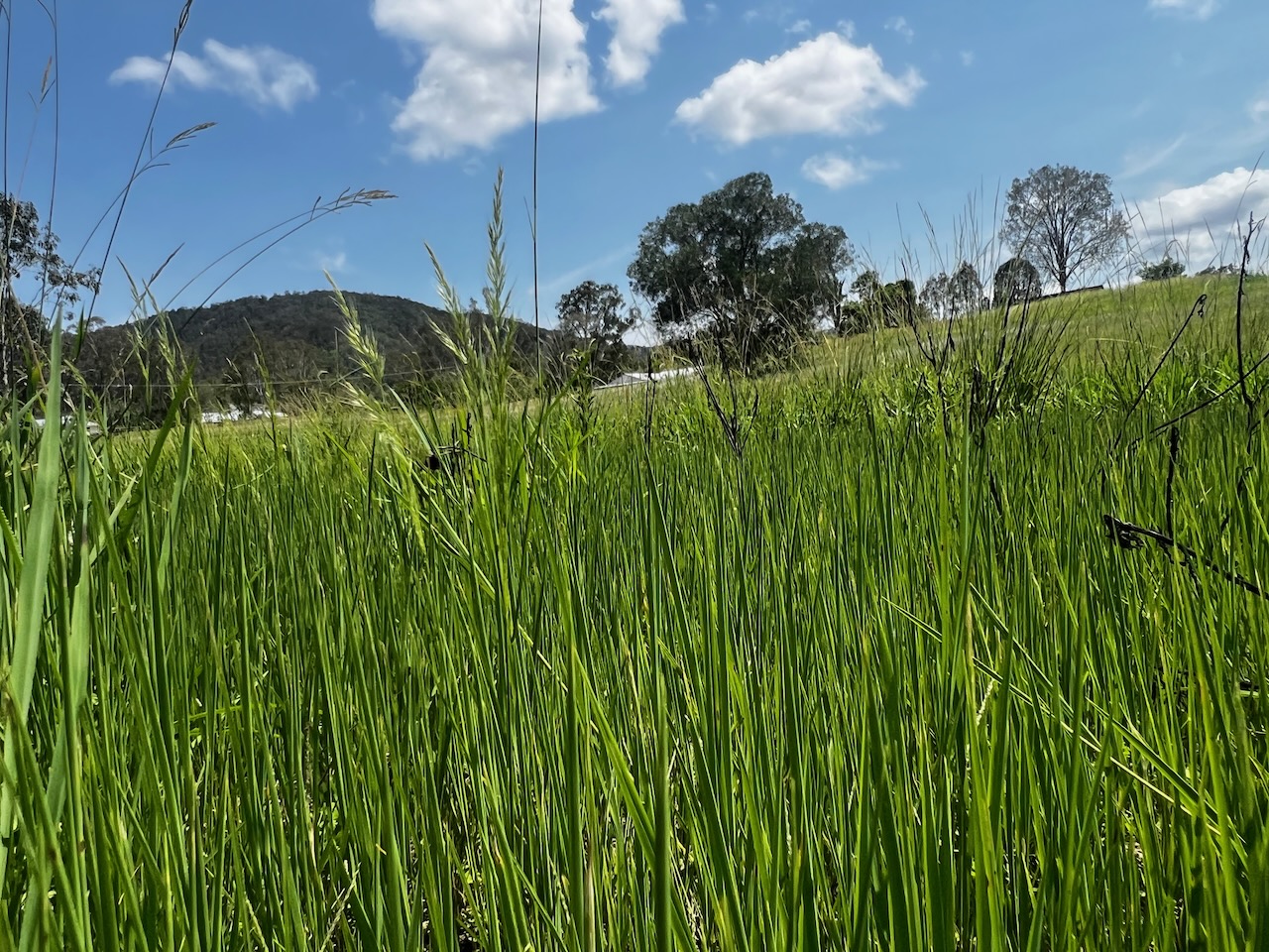
weedy grass in foreground and mountain behind
Predominant weedy grass species in SERF active regeneration area gulley, Summer 2024 (Image Keith Armstrong)

Recommendations (Dr. Peter Young/Dr. David Tucker) include include staged plantings of a relatively simple mix of Emergent species (Eucalyptus tereticornis, (forest red gum, blue gum / red irongum), Corymbia intermedia (pink bloodwood), Corymbia tesselaris (Moreton Bay ash)) and Canopy species (Melaleuca quinquenervia (broad-leaved paperbark, paper bark tea tree),  Melaleuca salicina (willow bottlebrush), Lophostemon sauveolens (Swamp Box, Swamp Turpentine) and Guoia semiglauca (guioa or wild quince) with the expectation that many of the subcanopy and shrub species will passively regenerate through the dispersal of seeds from birds, water, wind  etc. following canopy closure and site capture from initial stage 1 planting. There is the potential for later infill planting if there are significant gaps

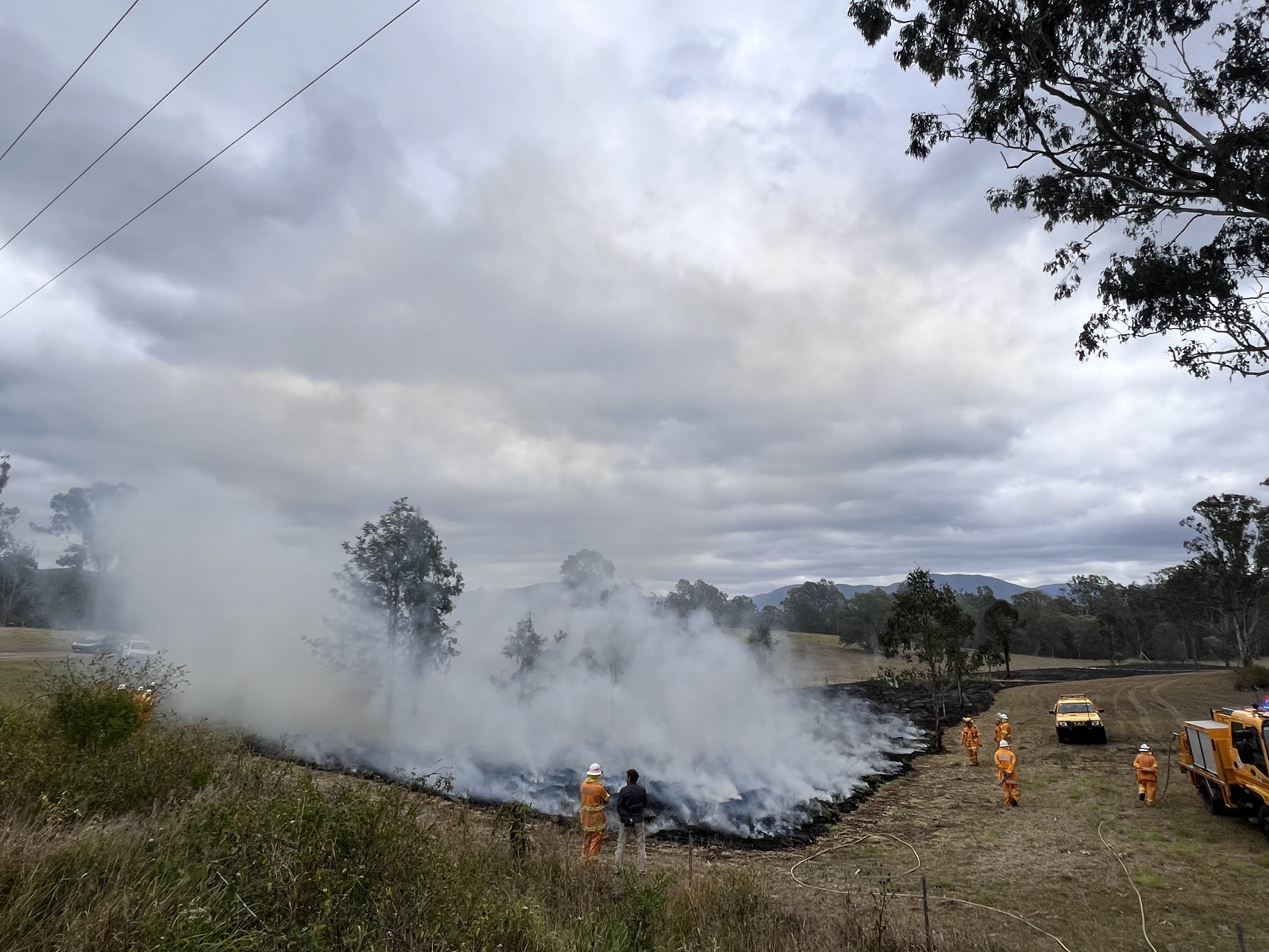
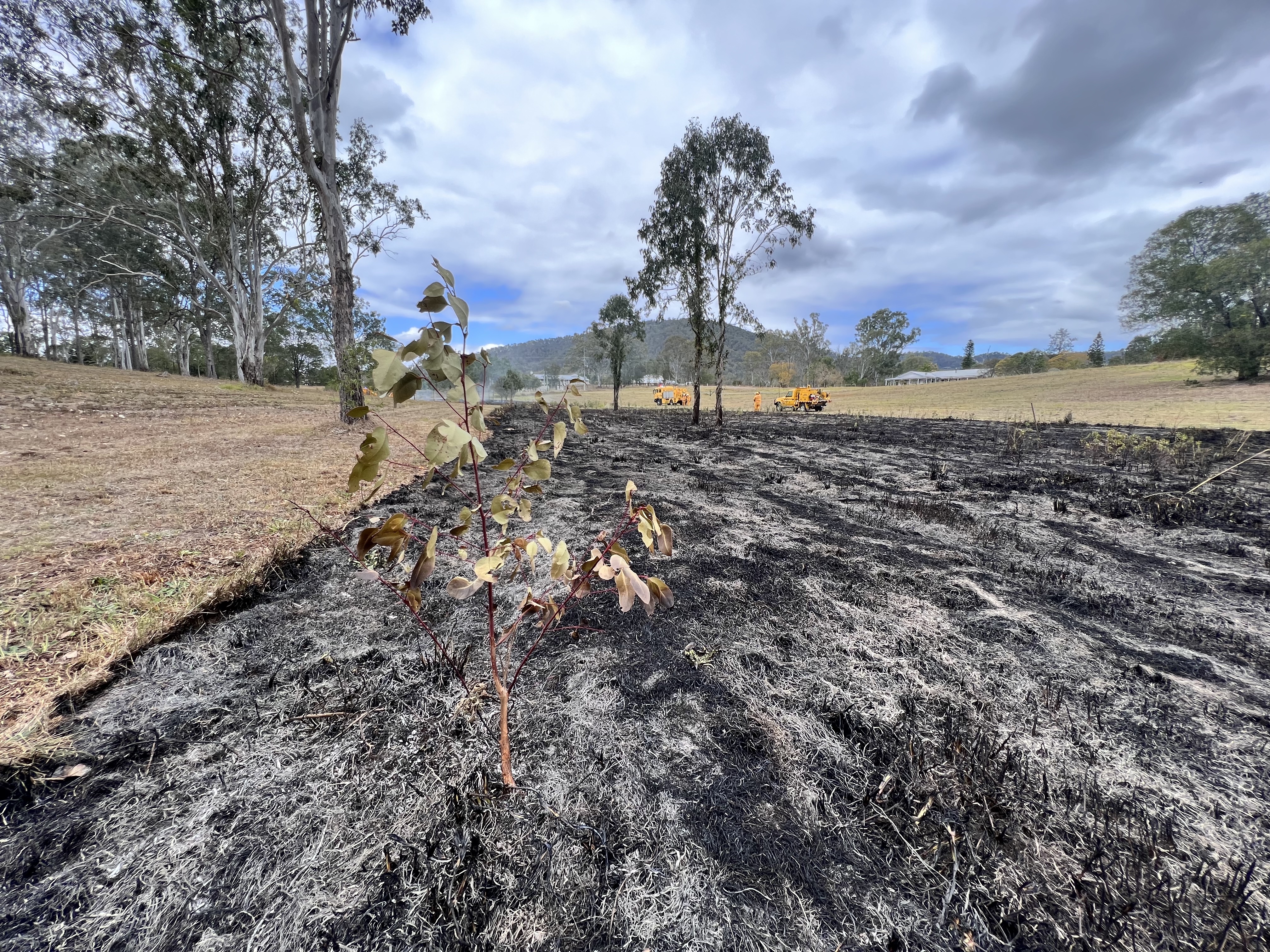
Burn Regeneration Area, SERF, Samford, Qld, 2023
Active Site – Burn day, SERF, Samford, Image Keith Armstrong
Burn Regeneration Area, SERF, Samford, Qld, 2023
Active Site – Burn day, SERF, Samford, Image Keith Armstrong


Setup (2): Initial Meeting with the Terrestrial Earth Research Network/TERN

Preamble

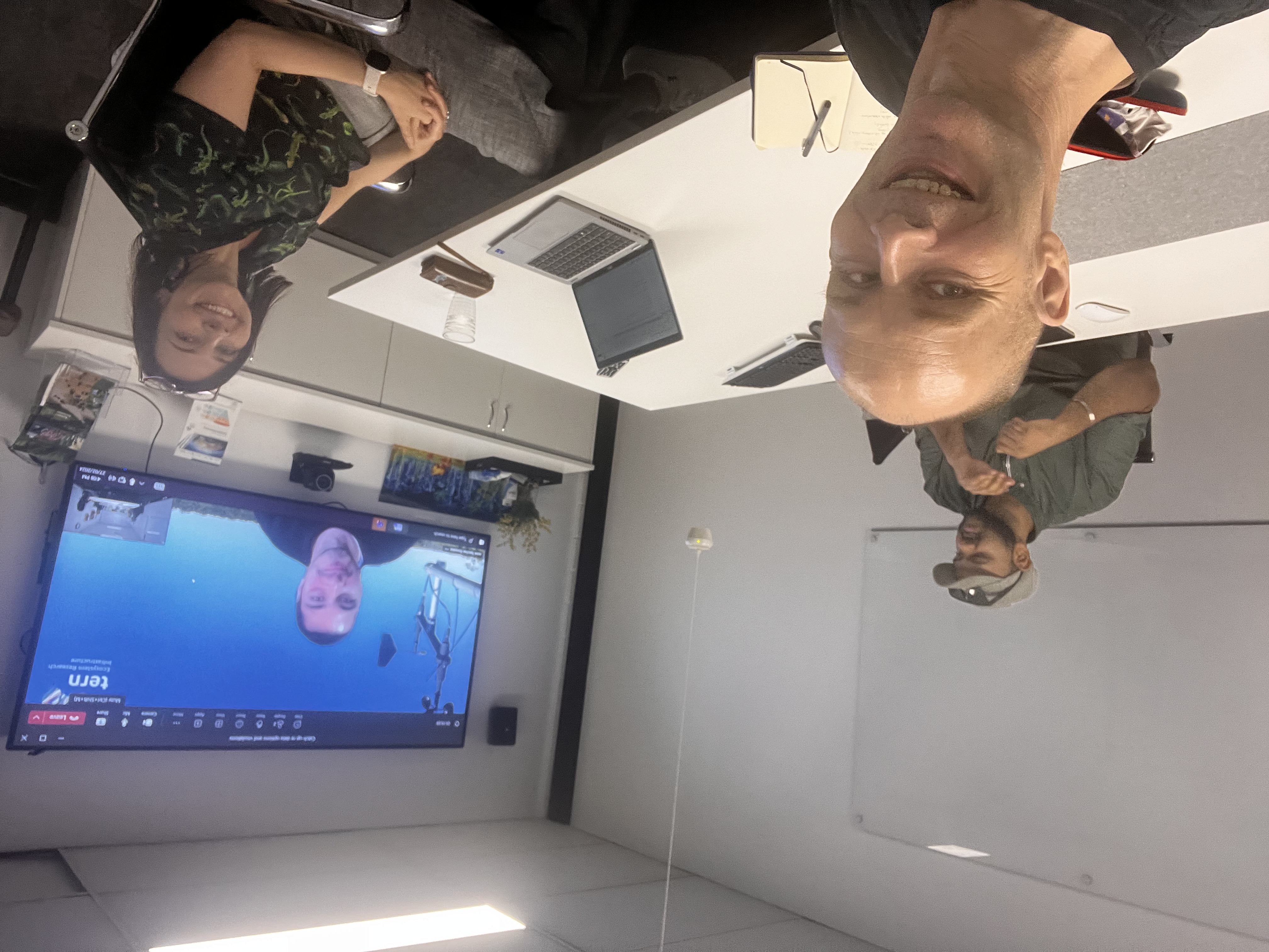
On 27th Feb, I accompanied one of my science collaborators Dr. Eleanor Velasquez – who is also our partner TERN’s (Terrestrial Ecology Research Network) Education Manager, to meet with her colleagues  Arun Singh Ramesh, Lachlan Charles and Javier Sanchez Gonzalez <Zooming from Madrid> at TERN HQ @University of Qld Long Pocket, Brisbane.

Meeting the TERN team on and offline in Brisbane, Feb 2024 (Image Keith Armstrong)

The meeting was primarily to discuss the data access and visualisation facilities that TERN offer.

We discussed all of the following data types that may be available to us going forward : –

Overview of TERN processes (Image courtesy of TERN)

TERN Landscapes / Land Observatory engages in Environmental reporting using remote sensing that is consistent across all sites. “TERN’s Landscape Monitoring platform conducts environmental monitoring and landscape observation using remote sensing techniques to characterise and monitor Australian ecosystems over time at a landscape and continental scale. The platform also undertakes specific modelling and synthesis activities (for clients) to extrapolate and interpolate from observational data to produce modelled data products”.

TERN’s data discovery portal page

Data Types:

Vegetation Structure and Change – Land cover, seasonal fractional cover (bare, green and non-green cover), uses quarterly time scales (3-month)

Soil – soil physicochemical attributes, lithology, soil organic carbon, pH, water availability, etc.

TERN Landscape visualiser – in this case ‘pyrogeography’ readings (Image courtesy of TERN)

This area of their folio engages: Land cover dynamics and phenology (i.e. the study of cyclic and seasonal natural phenomena, especially in relation to climate and plant and animal life), Vegetation composition and diversity, Fire dynamics and impacts, Vegetation structural properties and Biomass, Field survey datasets, Airborne datasets, Corrected surface reflectance products and other environmental and landscape research data such as solar radiation, rainfall, and water vapour pressure.

TERN Ecosystem Surveillance
This element of TERN’s capacity involves a range of measurement and recording types – such as the use of LIDAR to scan environments and the collection of CO2 data from Eddy Covariance flux towers. This area tracks the direction and magnitude of change in Australia’s environments over time, through sampling and surveying flora, soil and some invertebrates.

•Plot-based survey – uses 1ha plot

•Standardized protocol to monitor vegetation and soil attributes at
plot-level (e.g. AusPlots)
•Surveillance monitoring for the Ecological Monitoring System
Australia (EMSA) – DCCEEW

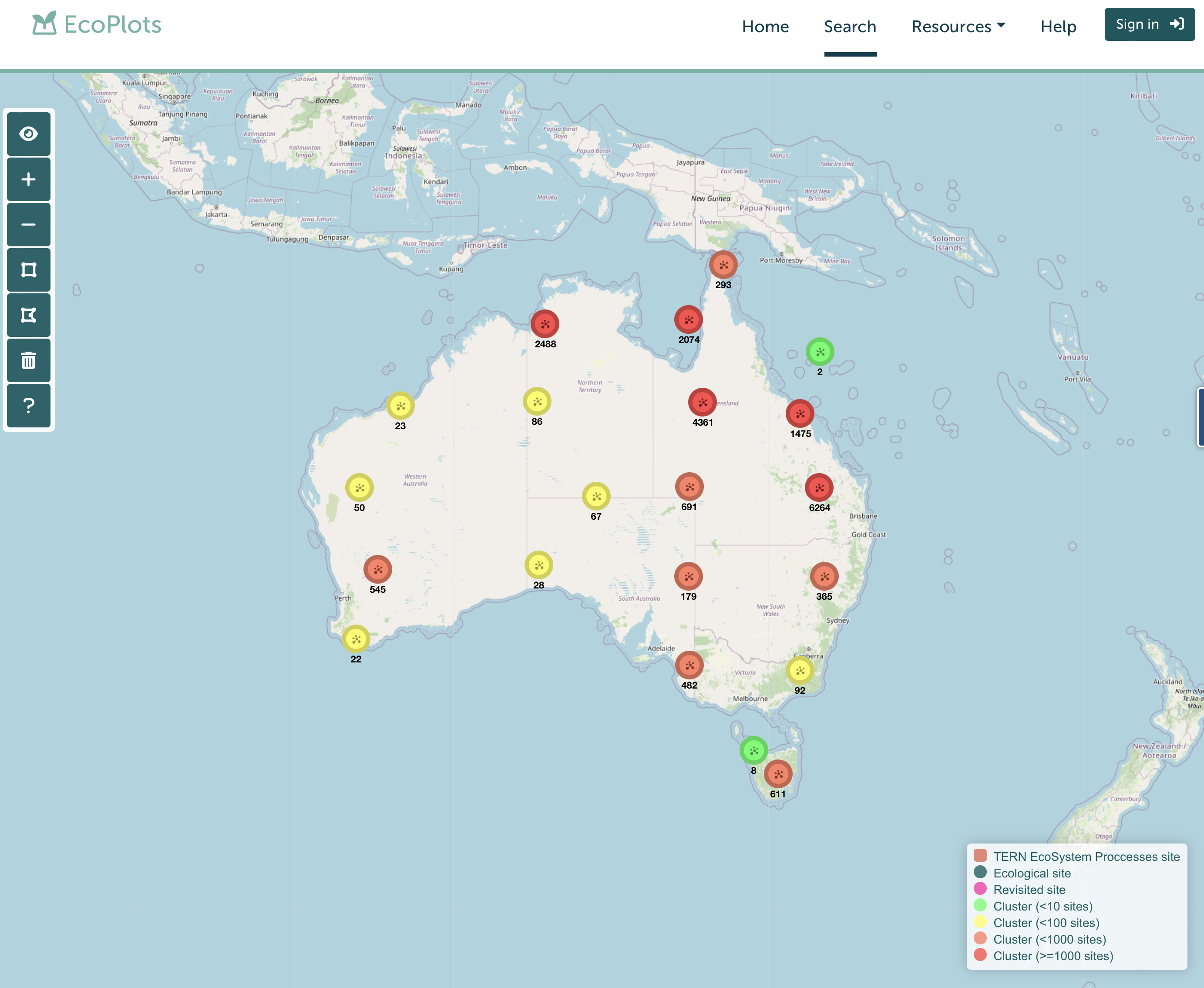
ecoplots.tern.org.au 

TERN Ecoplots Lead Page (Image courtesy of TERN)

TERN Ecosystem Processes
TERN’s Ecosystem Processes platform monitors the environment at a high level of detail at a small number of representative sites/key Australian biomes (called Super Sites) – of which TERN is one – categorised as a peri-urban site. 

Micrometerorological and land-surface and atmospheric processes – Sensor and flux data

•Vegetation CO2 and H2O fluxes

•Phenocams – phenology

Ozflux-tern/ ecoimages.tern.org.au

ecoimages.tern.org.au

Random phenocam image of the artwork site from 2015 – (longer grass is the area that was burnt in 2023) (Image courtesy TERN)

Clearly these data set types offer a host of possibilities. The data set is predominantly numerical data although images also exist – and therefore suggests the need for computational analysis going forward.

At this stage the LIDAR data held, the historic data from SERF (e.g. the super site readings and the phenocams) and the atmospheric data may be of future interest to this project. I would expect further discussion in the future as more specific pointers to the need for such data may emerge. Thank you for the team at TERN and Dr. Eleanor Velasquez for making the visit so successful 🙂